


CLINTON TWP Voting District, Linn County, Iowa
About
Outline

Summary
| Unique Area Identifier | 582683 |
| Name | CLINTON TWP Voting District |
| County | Linn County |
| State | Iowa |
| Area (square miles) | 26.34 |
| Land Area (square miles) | 26.09 |
| Water Area (square miles) | 0.25 |
| % of Land Area | 99.06 |
| % of Water Area | 0.94 |
| Latitude of the Internal Point | 41.99467860 |
| Longtitude of the Internal Point | -91.78953250 |
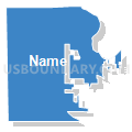
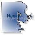
Maps


Graphs
Select a template below for downloading or customizing gragh for CLINTON TWP Voting District, Linn County, Iowa


Neighbors
Neighoring Voting District (by Name) Neighboring Voting District on the Map
- CANTON TWP W/SHELLSBURG Voting District, Benton County, IA
- CEDAR RAPIDS PCT 10, Linn County, IA
- CEDAR RAPIDS PCT 12, Linn County, IA
- CEDAR RAPIDS PCT 13, Linn County, IA
- CEDAR RAPIDS PCT 14, Linn County, IA
- CEDAR RAPIDS PCT 17, Linn County, IA
- CEDAR RAPIDS PCT 23, Linn County, IA
- FAIRFAX TWP Voting District, Linn County, IA
- FAYETTE TWP Voting District, Linn County, IA
- FLORENCE TWP PART W/O WALFORD Voting District, Benton County, IA
- FREMONT TWP Voting District, Benton County, IA
- MONROE TWP PCT 1, Linn County, IA
Top 10 Neighboring County Subdivision (by Population) Neighboring County Subdivision on the Map
- Cedar Rapids city, Linn County, IA (126,326)
- Monroe township, Linn County, IA (13,020)
- Fairfax township, Linn County, IA (3,533)
- Fremont township, Benton County, IA (2,442)
- Florence township, Benton County, IA (2,108)
- Fayette township, Linn County, IA (1,267)
- Canton township, Benton County, IA (883)
- Clinton township, Linn County, IA (871)
Top 10 Neighboring Place (by Population) Neighboring Place on the Map
Top 10 Neighboring Unified School District (by Population) Neighboring Unified School District on the Map
- Cedar Rapids Community School District, IA (119,310)
- College Community School District, IA (23,720)
- Vinton-Shellsburg Community School District, IA (10,406)
- Benton Community School District, IA (9,140)
Top 10 Neighboring State Legislative District Lower Chamber (by Population) Neighboring State Legislative District Lower Chamber on the Map
- State House District 35, IA (35,173)
- State House District 33, IA (32,311)
- State House District 37, IA (31,767)
- State House District 39, IA (29,919)
- State House District 34, IA (28,737)
Top 10 Neighboring State Legislative District Upper Chamber (by Population) Neighboring State Legislative District Upper Chamber on the Map
- State Senate District 18, IA (72,360)
- State Senate District 17, IA (61,048)
- State Senate District 19, IA (59,384)
- State Senate District 20, IA (59,062)
Top 10 Neighboring 111th Congressional District (by Population) Neighboring 111th Congressional District on the Map
Top 10 Neighboring Census Tract (by Population) Neighboring Census Tract on the Map
- Census Tract 30.01, Linn County, IA (9,226)
- Census Tract 9.02, Linn County, IA (6,092)
- Census Tract 106, Linn County, IA (5,827)
- Census Tract 9605, Benton County, IA (5,760)
- Census Tract 107, Linn County, IA (5,639)
- Census Tract 10.01, Linn County, IA (4,170)
- Census Tract 2.05, Linn County, IA (3,991)
- Census Tract 10.02, Linn County, IA (3,467)
- Census Tract 9604, Benton County, IA (3,270)
Top 10 Neighboring 5-Digit ZIP Code Tabulation Area (by Population) Neighboring 5-Digit ZIP Code Tabulation Area on the Map
- 52404, IA (37,796)
- 52405, IA (23,621)
- 52411, IA (6,896)
- 52228, IA (2,772)
- 52206, IA (2,303)
- 52324, IA (1,890)